 |
 |
Kachin Tribal Village Trek, Burma/Myanmar
Mysterious Burma. Yes, you may have heard that it’s called Myanmar these days. For many, however, there is something magical and even foreboding about the name Burma. What often comes to mind are deep jungles, brutal wars, Orwellian military dictatorships and, of course, really hard to build roads. The Kachin State is home to all of these qualities, both historically and in current times. This area is one of the least visited of all Himalayan regions and not surprisingly one of the least visited parts of Burma. Closed to foreigners since shortly after WWII, it just opened up to travelers a few years before our trek. Fascinating new tribes and rare new species from all phyla in the animal kingdom were recently “discovered” in this remote area. You can visit several tribal villages and head out from the “last village” to the untamed forests and ultimately scale the heights of the remote Mt. Phon Khan Razi.
Getting off the beaten path in Burma is like no other place. Burma’s isolation over the past sixty years creates a real opportunity to travel back in time and is the main reason for our inclusion of this trek. However, by the time you read this, it may already be too late to have an experience equal to our own. Do some homework and research an equally remote trek for a parallel experience.
Fundamentals Days Trekking: 10
Highlights
When to Go The best time for trekking in northern Burma is February through May. The weather is pleasant, leaves are on the trees and bird migrations are passing through the country. Note that Burma is one of the world’s best places to bird watch as the geography integrates a wide variety species. After May it gets quite hot and the monsoon season rolls up from the Indian Ocean. It lasts through October. November through February is colder, although trekking is still possible.
Guided vs Independent Treks Myanmar is under the leadership of a military dictatorship, which requires permits for any treks or explorations that get off the beaten path. There are only a handful of approved companies that lead trips to these far off places. You will need to coordinate in advance to make sure you will be able to obtain permits and guides. The government will likely provide an escort to keep a watchful eye on your behavior. Don’t be deterred, ultimately they are looking after your well being as well as their own interests. They want you to have a safe and enjoyable trip so you can return to your country to say how wonderful, safe and friendly it is in Burma. |
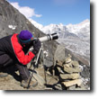
 Click to Enlarge
Access / Local Information Access to Myanmar is primarily through Thailand. Overland crossings are limited and your best options to access the country are by flights from Bangkok to Yangon. To get to the remote Kachin State from Yangon, fly to Mandalay to Myitkyina to Putao. From the dusty dirt landing strip in Putao, it is a several hour jeep ride to the trail head. Alternately and more interestingly, you can take the train most of the way from Yangon. If you do, you will get a real sense of the countryside and small town life of Burma.
Orientation Myanmar sits geographically between India, Bangladesh, China and Thailand and interestingly combines the geographic, cultural, culinary and religious elements of the Indian subcontinent, the Himalayas, tropical South East Asia and tribal Asian hill country. Putao is about as far north as you can go, near the Indian border and the last stop with internal combustion before beginning your trek.
Difficulty The trails and trek are not extremely arduous, however, traveling to and around Burma can be. The trail diminishes to a hunters path after the last village on your way to climb Mt. Phon Kahn Razi. The Kachin state is in remote northern Myanmar and you are required to bring virtually everything you need from Yangon or Mandalay, so be prepared. Additionally, unless you fly everywhere, be prepared for long, very long, bus and train journeys. |
![]()
Day to Day Account - Jeff Salvage - Kachin Village Trek, Burma/Myanmar
 Friends can be crafty influencers. Once again I found myself headed on an adventure not knowing what to expect. A busy work schedule and house rebuilding were justifications for my ignorance, but these were superficial reasons for my lack of research. Visiting the mysterious country of Myanmar, or Burma, as those of us less aligned with the military regime that took over in 1962 like to call it, isn’t exactly on most people’s bucket list. I was headed to remote areas of Northern Burma at the invite of my now good friends Kirk and Nancy whom I met in Nepal. Very little reliable tourist information was available and a complete dearth of trekking information existed. The story continues...
